Get Highest Layer Point Clouds
Function Description
Sorts the center points of each point cloud along a specified reference direction, thereby extracting point clouds at the highest layer.
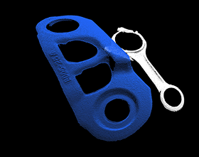
Use Cases
Suitable for filtering out point clouds at the highest layer in a specified reference direction. Typically used after steps such as “Point Cloud Clustering” and “Extract Point Clouds from Corresponding Masks”.
Inputs
Point Cloud with Normals (Required): Point clouds with normals to be processed.
Labels (Optional): Labels of target objects, usually the labels of target objects output by deep learning related steps.
Confidence (Optional): Confidence of target objects, usually the confidence of target objects output by deep learning related steps.
Layer Height (Optional): Defines the height range of the highest layer point clouds. Point clouds within this range will be retained.
Outputs
Point Cloud with Normals: Processed point clouds.
Classification Labels: Labels corresponding to the highest layer point clouds (filtering results).
Confidence: Confidence corresponding to the highest layer point clouds (filtering results).
Highest Layer Index: Index of the highest layer point clouds in the input point clouds.
Parameters
Reference Direction
X, Y, Z
Defines the reference direction by setting values of X, Y, Z to determine the direction for judging the highest layer. For example:
X = 0; Y = 0; Z = 1: Means extracting point clouds highest in the +Z direction.
X = 0; Y = 0; Z = -1: Means extracting point clouds highest in the -Z direction.
Layer Settings
Only Output Highest Item
Checked: Only extract a single point cloud that is highest along the specified direction
Unchecked: Extract all highest layer point clouds within the set layer height range
Layer Height
(Only takes effect when “Only Output Highest Item” is unchecked, and when the “Layer Height” output port has no input.)
Defines the height range of the highest layer point clouds. Point clouds within this range will be retained.
Layer Tolerance (0.0~1.0)
(Only takes effect when “Only Output Highest Item” is unchecked.)
Used to set the upper limit of height difference between the highest layer and other layers (Layer Height × Layer Tolerance).
Value range: [0,1].
If the height difference between a point cloud and the highest layer is less than this upper limit, it is determined that the point cloud belongs to the highest layer. When point clouds from the next layer are incorrectly judged as the highest layer, this parameter can be appropriately reduced to correct.